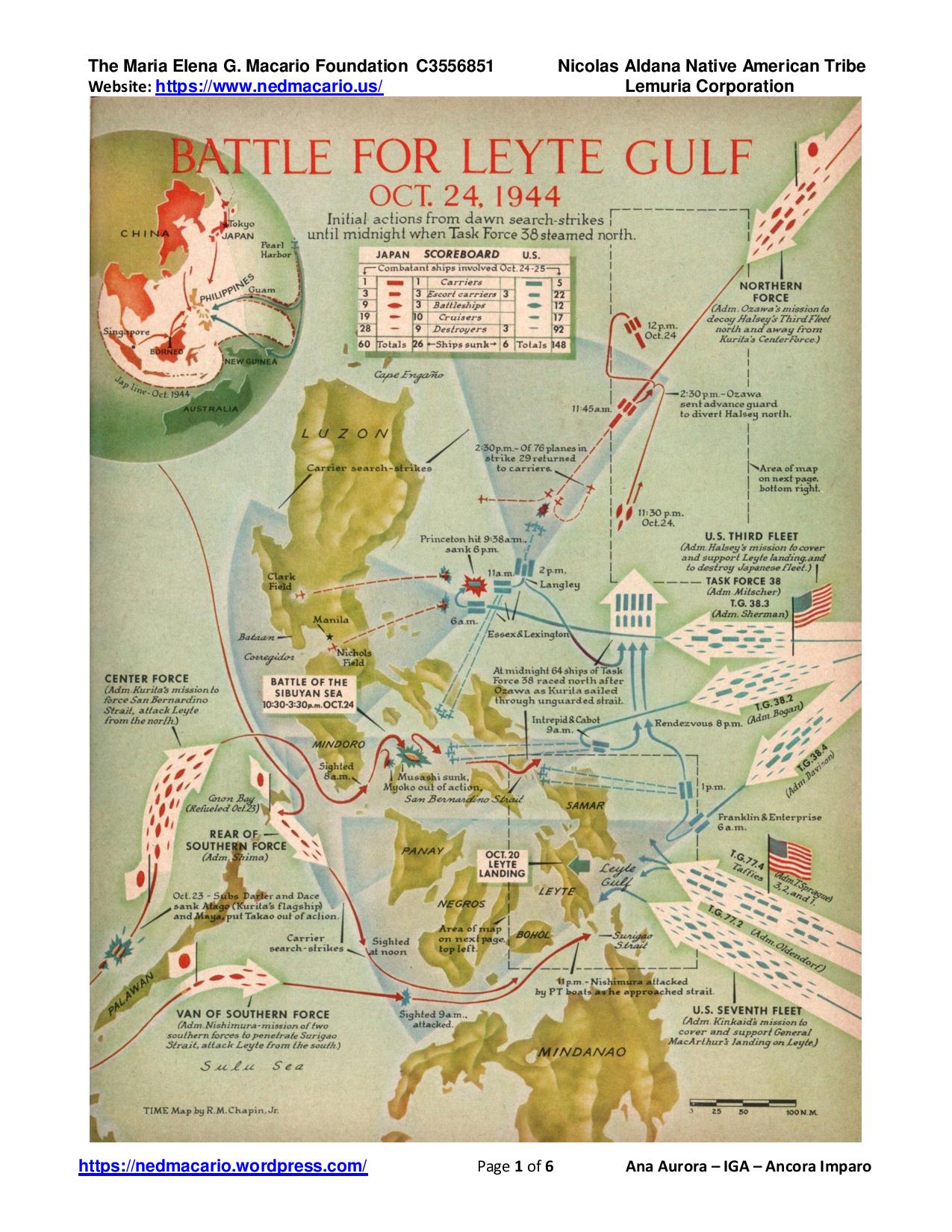
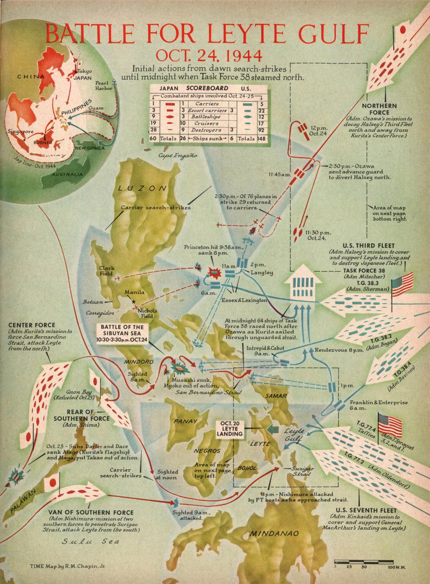
Photo 1 – Map showing Japanese Imperial Navy’s ship dispositions and movements opposite that of the U.S. Navy during the Battle of Leyte Gulf, Oct. 23-26, 1944. The entire Philippines should be made a Japanese-American Battle Monument.
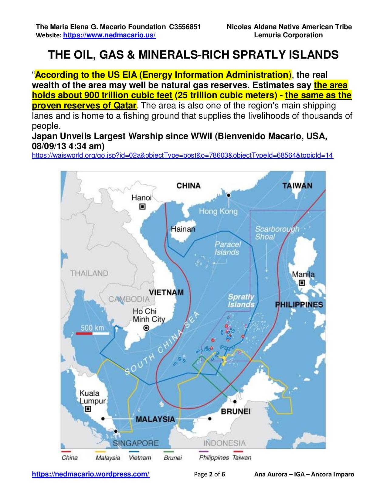
Photo 2 – Map showing overlapping claims on the oil, gas and minerals-rich Spratlys in the South China Sea.
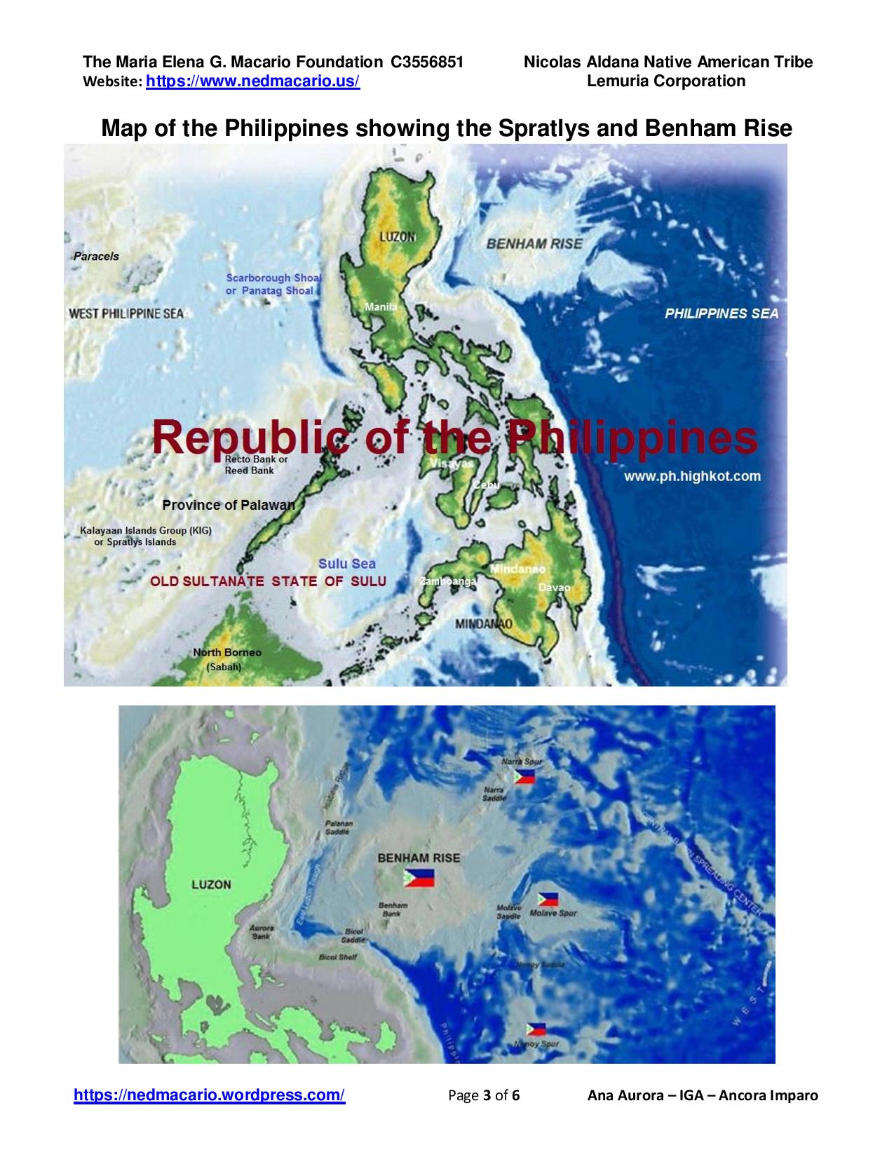
Photo 3 – Map showing the Spratlys west of Palawan, the Scarborough shoals directly opposite the old U.S. Navy base in Subic while Benham Rise runs parallel to the eastern side of Luzon.
Benham Rise is a submerged extinct volcanic ridge located at 16 degrees 30 minutes N, 124 degrees 45 minutes E off the coast of Luzon. Benham Rise keeps a large amount of heavy metals like manganese, whose accumulation into manganese nodules can help in the production of steel, among other things. Considering the area is a seabed, which is known to contain gas hydrates, Benham Rise is also potentially a rich source of natural gas.
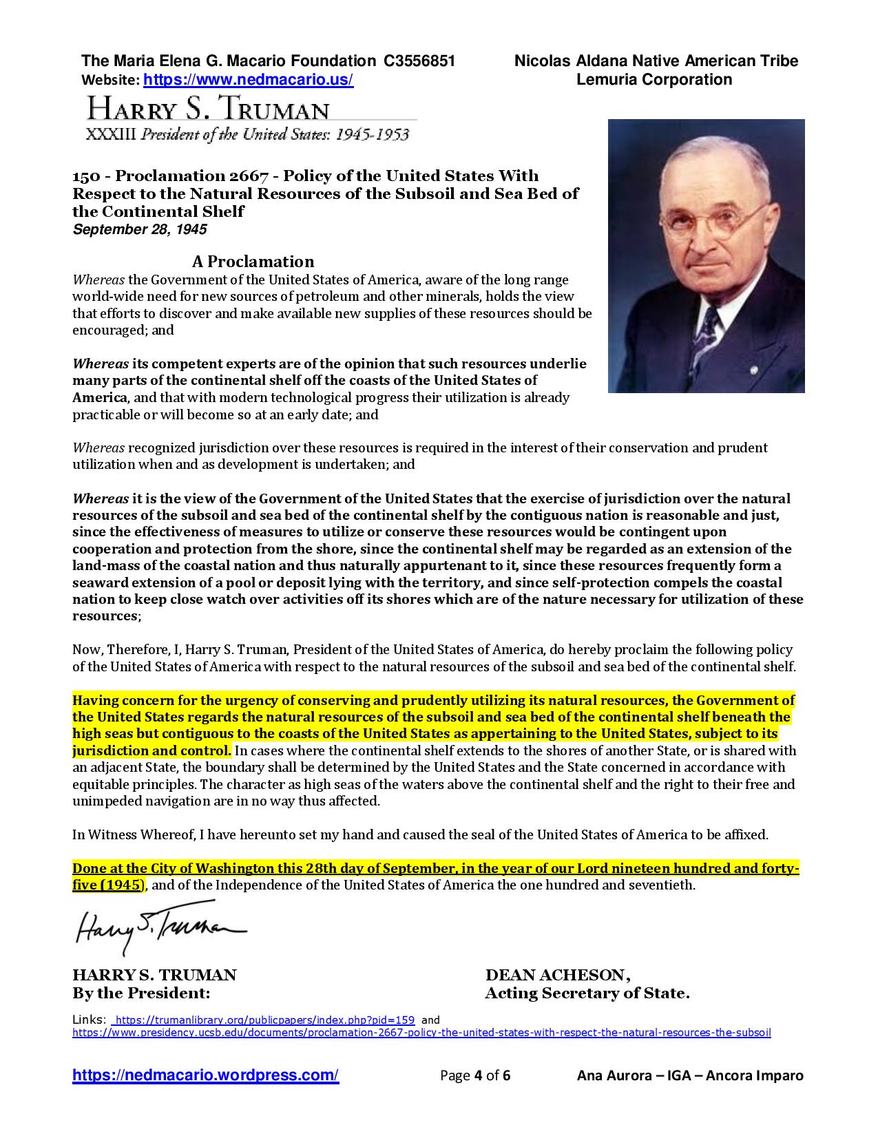
Photo 4 – Pres. Harry S. Truman’s 150 Proclamation 2667 dated Sept. 28, 1945, establishing the 200-mile EEZ (Exclusive Economic Zone) and extending the U.S.A.’s jurisdiction over the exploration and exploitation of marine and other resources in its adjacent section of the continental shelf. At this time, the Philippines was not yet granted independence and therefore an integral part of the U.S.A.
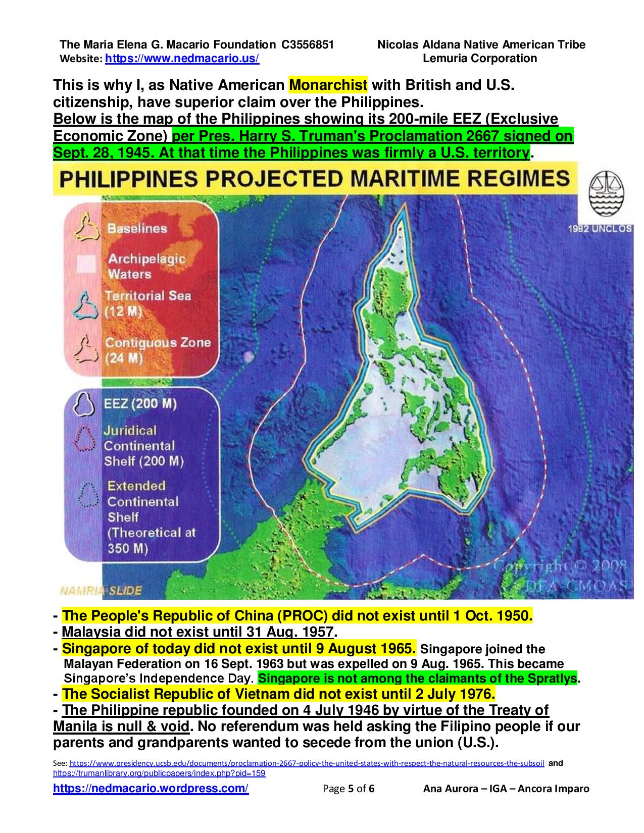
Photo 5 – Map of the Philippines showing the 200-mile EEZ Exclusive Economic Zone) all around the Philippine archipelago.
Sept 9, 2016 – We should make the entire Philippines a Japanese-American Battle Monument and hold annual reenactments of the Battle for Leyte Gulf every Oct. 23-26 with full participation of the Japanese Imperial Navy or Japan’s Self-Defense Force. US and Japanese naval forces shall retrace the steps taken in WWII. Admiral Kurita’s Center Force will be positioned in the Spratlys area where they were on Oct. 23, 1945. See Map below:
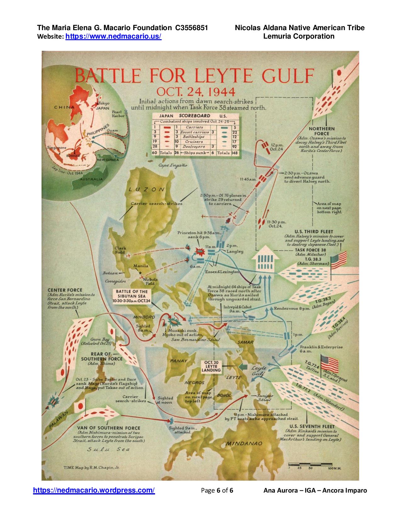
Photo 6 – This map shows that during the Battle of Leyte Gulf, Oct. 23-26, 1944, while Adm. Kurita’s force was all over the disputed shoals, reefs, atolls and artificial islands in te the Spratlys, Adm. Ozawa’s Northern force was all over Benham Rise This is why the entire Philippines should be made a Japanese-American Battle Monument.